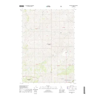
2020 Map of Bear Creek Point
USGS Topo · Published 2020About this map
The Middle Fork Salmon Wild and Scenic River flows through the southeastern corner of this Valley County landscape, marking a protected corridor at the intersection of the Salmon National Forest and Boise National Forest. The topography is dominated by a complex network of drainages and high points, most notably Bear Creek Point, which serves as a central landmark for the surrounding ridges. Dozens of waterways, including Brush Creek, Sheep Cr, and Paradise Cr, carve through the terrain, creating deep features such as Countess Gulch and Tappan Gulch. The map reveals the lack of modern development in this wilderness area, emphasizing natural landmarks like Cow Basin and the winding course of the Middle Fork Salmon River as it passes through the remote canyon environment near the Lemhi County border.
Find a feature on this map
36 named features on this map. Tap any name to fly to it.
Don’t see what you’re looking for? This feature index may not catch every label — zoom into the map to look around manually.
Map Details
Editions of this 2020 Bear Creek Point Map
This is the sole edition of this map. No revisions or reprints were ever made.
Other maps of this area

1930 · Casto
USGS Topo · 1:125,000

1956 · Elk City
USGS Topo · 1:250,000

1957 · Challis
USGS Topo · 1:250,000

1960 · Elk City
USGS Topo · 1:250,000

1960 · Challis
USGS Topo · 1:250,000

1962 · Mormon Mtn
USGS Topo · 1:24,000

1962 · Bear Creek Point
USGS Topo · 1:24,000

1962 · Puddin Mtn
USGS Topo · 1:24,000

1962 · Norton Ridge
USGS Topo · 1:24,000

1962 · Shellrock Peak
USGS Topo · 1:24,000