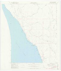
1969 Map of Bear Harbor
USGS Topo · Published 1974About this map
Our Lady of the Redwoods Abbey sits near the headwaters of the Mattole River, marking a spiritual landmark within the secluded landscape of northern Mendocino County. This 1969 survey illustrates a coastline defined by dramatic verticality and isolation, where the King Range National Conservation Area meets the Pacific. The terrain is deeply incised by drainages such as Whale Gulch and Jackass Creek, creating a complex network of ridges like Jackass Ridge.
Find a feature on this map
52 named features on this map. Tap any name to fly to it.
Don’t see what you’re looking for? This feature index may not catch every label — zoom into the map to look around manually.
Map Details
Editions of this 1969 Bear Harbor Map
4 editions found
Other maps of this area

1920 · Pt. Delagda
USGS Topo · 1:62,500

1921 · Briceland
USGS Topo · 1:62,500

1949 · Eureka
USGS Topo · 1:250,000

1949 · Point Delgada
USGS Topo · 1:62,500

1949 · Garberville
USGS Topo · 1:62,500

1950 · Piercy
USGS Topo · 1:62,500

1951 · Garberville
USGS Topo · 1:62,500

1951 · Point Delgada
USGS Topo · 1:62,500

1957 · Ukiah
USGS Topo · 1:250,000

1958 · Redding
USGS Topo · 1:250,000