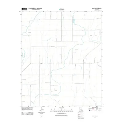
2012 Map of Bear Skin
USGS Topo · Published 2012About this map
Bear Skin and Newhope represent the primary nodes of settlement in this part of West Carroll Parish, where the landscape is defined by the winding course of the Boeuf River along the western boundary. The terrain is characterized by an intricate drainage system of bayous and creeks, including Bear Skin Bayou, Big Colewa Cr, and Little Colewa Cr, which carve through the agricultural layout.
Find a feature on this map
50 named features on this map. Tap any name to fly to it.
Don’t see what you’re looking for? This feature index may not catch every label — zoom into the map to look around manually.
Map Details
Editions of this 2012 Bear Skin Map
This is the sole edition of this map. No revisions or reprints were ever made.
Other maps of this area

1935 · Hurricane
USGS Topo · 1:62,500

1935 · Oak Grove
USGS Topo · 1:62,500

1935 · Bonita
USGS Topo · 1:62,500

1955 · Jackson
USGS Topo · 1:250,000

1958 · Oak Grove
USGS Topo · 1:62,500

1958 · Hurricane
USGS Topo · 1:62,500

1958 · Bonita
USGS Topo · 1:62,500

1959 · Mitchiner
USGS Topo · 1:62,500

1961 · Jackson
USGS Topo · 1:250,000

1962 · Jackson
USGS Topo · 1:250,000