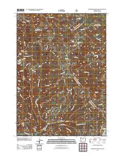
2011 Map of Bearbones Mountain
USGS Topo · Published 2011About this map
Helena Mine and the Noonday Mine sit high on the ridges of the Calapooya Mountains, documenting a legacy of mineral extraction in this corner of Lane County. This 2011 survey reveals a landscape where industry and geography are deeply intertwined, with the Mayflower Mine and Colorado Mine situated near the headwaters of numerous creeks. The terrain is marked by prominent summits like Bearbones Mountain and Grizzly Mountain, while drainage systems such as Horse Heaven Creek and Steamboat Creek carve through the deep valleys. The presence of Skeeter Camp and the Gertrude Shelter near Gertrude Lake indicates the area's transition into a space for backcountry recreation and forest management. A dense network of Forest Service roads, including Usfs RD 2212, provides access to these remote reaches, connecting landmarks like Frog Rock and Johnson Meadows across the high-elevation divide.
Find a feature on this map
51 named features on this map. Tap any name to fly to it.
Don’t see what you’re looking for? This feature index may not catch every label — zoom into the map to look around manually.
Map Details
Editions of this 2011 Bearbones Mountain Map
This is the sole edition of this map. No revisions or reprints were ever made.
Other maps of this area

1917 · Diamond Lake
USGS Topo · 1:125,000

1925 · Waldo Lake
USGS Topo · 1:125,000

1935 · Lowell
USGS Topo · 1:96,000

1942 · Lowell
USGS Topo · 1:125,000

1955 · Illahee Rock
USGS Topo · 1:62,500

1955 · Fairview Peak
USGS Topo · 1:62,500

1956 · Toketee Falls
USGS Topo · 1:62,500

1956 · Oakridge
USGS Topo · 1:62,500

1958 · Roseburg
USGS Topo · 1:250,000

1959 · Roseburg
USGS Topo · 1:250,000