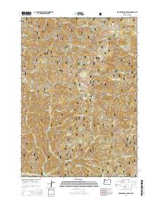
2014 Map of Bearbones Mountain
USGS Topo · Published 2014About this map
Bearbones Mountain and the Calapooya Mountains form the backbone of this high-elevation terrain on the border of the Umpqua National Forest and Willamette National Forest. This 2014 survey documents a landscape defined by dramatic ridgelines including Noonday Ridge, Monte Rico Ridge, and Jackass Ridge, separated by a dense network of watercourses. The drainage patterns of Brice Cr and Steamboat Cr indicate the steep verticality of the region, while small alpine features like Windfall Lake and Gertrude Lake provide specific geographic markers. Points of interest for local history and topography include Johnson Meadows and several distinct peaks such as Grass Mtn and Grizzly Mtn. The inclusion of Natl Forest Develop Road 2110 Rd and other service routes illustrates the modern management and accessibility of these remote timberlands and watershed areas.
Find a feature on this map
44 named features on this map. Tap any name to fly to it.
Don’t see what you’re looking for? This feature index may not catch every label — zoom into the map to look around manually.
Map Details
Editions of this 2014 Bearbones Mountain Map
This is the sole edition of this map. No revisions or reprints were ever made.
Other maps of this area

1917 · Diamond Lake
USGS Topo · 1:125,000

1925 · Waldo Lake
USGS Topo · 1:125,000

1935 · Lowell
USGS Topo · 1:96,000

1942 · Lowell
USGS Topo · 1:125,000

1955 · Illahee Rock
USGS Topo · 1:62,500

1955 · Fairview Peak
USGS Topo · 1:62,500

1956 · Toketee Falls
USGS Topo · 1:62,500

1956 · Oakridge
USGS Topo · 1:62,500

1958 · Roseburg
USGS Topo · 1:250,000

1959 · Roseburg
USGS Topo · 1:250,000