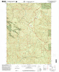
1997 Map of Bearbones Mountain
USGS Topo · Published 1999About this map
The Calapooya Mountains divide this landscape, marking the high-altitude boundary between the Umpqua National Forest and Willamette National Forest. This 1997 revision of the 1980 topography reveals a rugged terrain defined by industrial history and primitive wilderness access. Evidence of the region's mining heritage is clear through the presence of the Noonday Mine near Helena Saddle and the Mayflower Mine further south. These sites, coupled with numerous unnamed quarries, suggest a landscape shaped by resource extraction and logging roads.
Find a feature on this map
42 named features on this map. Tap any name to fly to it.
Don’t see what you’re looking for? This feature index may not catch every label — zoom into the map to look around manually.
Map Details
Editions of this 1997 Bearbones Mountain Map
This is the sole edition of this map. No revisions or reprints were ever made.
Other maps of this area

1917 · Diamond Lake
USGS Topo · 1:125,000

1925 · Waldo Lake
USGS Topo · 1:125,000

1935 · Lowell
USGS Topo · 1:96,000

1942 · Lowell
USGS Topo · 1:125,000

1955 · Illahee Rock
USGS Topo · 1:62,500

1955 · Fairview Peak
USGS Topo · 1:62,500

1956 · Toketee Falls
USGS Topo · 1:62,500

1956 · Oakridge
USGS Topo · 1:62,500

1958 · Roseburg
USGS Topo · 1:250,000

1959 · Roseburg
USGS Topo · 1:250,000