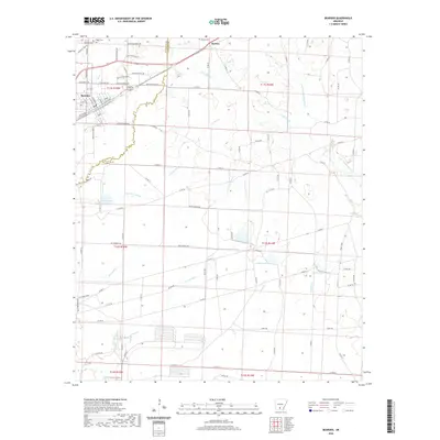
2020 Map of Bearden
USGS Topo · Published 2020About this map
Bearden serves as the primary settlement on this landscape where the borders of Ouachita and Calhoun counties meet. The area is defined by an intricate network of waterways, including the winding Two Bayou and Locust Bayou, which transition into wetlands such as Covington Pond and Middle Pond. To the northeast, the smaller community of Harlow sits near its namesake Harlow Cemetery, illustrating the rural burial patterns common in southern Arkansas.
Find a feature on this map
48 named features on this map. Tap any name to fly to it.
Don’t see what you’re looking for? This feature index may not catch every label — zoom into the map to look around manually.
Map Details
Editions of this 2020 Bearden Map
This is the sole edition of this map. No revisions or reprints were ever made.
Other maps of this area

1903 · Camden
USGS Topo · 1:125,000

1953 · El Dorado
USGS Topo · 1:250,000

1957 · El Dorado
USGS Topo · 1:250,000

1958 · El Dorado
USGS Topo · 1:250,000

1960 · El Dorado
USGS Topo · 1:250,000

1966 · Fordyce
USGS Topo · 1:24,000

1973 · Bearden
USGS Topo · 1:24,000
1973 · Eagle Mills
USGS Topo · 1:24,000
1973 · Holly Springs
USGS Topo · 1:24,000
1973 · East Camden
USGS Topo · 1:24,000