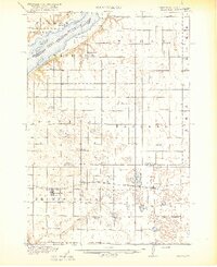
1918 Map of Beardsley
USGS Topo · Published 1918About this map
Lake Traverse defines the northwestern boundary of this prairie landscape, where the Roberts Co Traverse Co Boundary Line marks the transition between Minnesota and South Dakota. Surveyed just before the end of the First World War, the map reveals a highly organized township system dotted with over a dozen numbered and named rural schoolhouses, such as Round Mound School and Theake School, which served the dispersed farming families of the era.
Find a feature on this map
41 named features on this map. Tap any name to fly to it.
Don’t see what you’re looking for? This feature index may not catch every label — zoom into the map to look around manually.
Map Details
Editions of this 1918 Beardsley Map
3 editions found
Other maps of this area

1915 · White Rock
USGS Topo · 1:62,500

1916 · Peever
USGS Topo · 1:62,500

1916 · Beardsley
USGS Topo · 1:62,500

1917 · New Effington
USGS Topo · 1:62,500

1918 · Peever
USGS Topo · 1:62,500

1918 · White Rock
USGS Topo · 1:62,500

1918 · Beardsley
USGS Topo · 1:62,500

1950 · Graceville
USGS Topo · 1:62,500

1951 · Wheaton
USGS Topo · 1:62,500

1953 · Ortonville
USGS Topo · 1:62,500