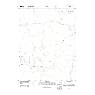
2011 Map of Bears Ears Peaks
USGS Topo · Published 2011About this map
Slater Park sits at the heart of this high-elevation landscape in Routt County, where numerous drainages carve through the Elkhead Mountains. The area is defined by a dense network of mountain streams, including Grizzly Creek, Douglas Creek, and the uniquely named Hole-in-the-Wall Creek. Significant topographic landmarks such as Sugar Loaf Mountain, Saddle Mountain, and the prominent Bears Ears Peaks provide clear orientation points within the surrounding forest lands. This 2011 survey illustrates the modern road system, from County Hwy-82 in the north to the more primitive routes like Co RD 3w that penetrate the high country. To the southeast, the open expanse of California Park transitions into a complex of smaller waterways like Circle Creek and Jokodowski Creek, showing the intricate headwaters that sustain this region.
Find a feature on this map
32 named features on this map. Tap any name to fly to it.
Don’t see what you’re looking for? This feature index may not catch every label — zoom into the map to look around manually.
Map Details
Editions of this 2011 Bears Ears Peaks Map
This is the sole edition of this map. No revisions or reprints were ever made.
Other maps of this area

1923 · Elkhead Creek
USGS Topo · 1:62,500

1923 · Pilot Knob
USGS Topo · 1:62,500

1924 · Elkhead Creek
USGS Topo · 1:62,500

1925 · Pilot Knob
USGS Topo · 1:62,500

1954 · Craig
USGS Topo · 1:250,000

1957 · Craig
USGS Topo · 1:250,000

1958 · Craig
USGS Topo · 1:250,000

1960 · Craig
USGS Topo · 1:250,000

1962 · Craig
USGS Topo · 1:250,000
1962 · Tumble Mountain
USGS Topo · 1:24,000