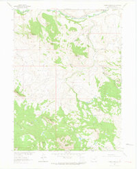
1962 Map of Tumble Mountain
USGS Topo · Published 1964About this map
The Little Snake River winds across this high-elevation landscape in Routt County, marking a remote frontier where livestock ranching and rugged topography meet. Near the northern boundary, Focus Ranch and the A Diamond J Ranch sit along the riverbanks, supported by a Gaging Sta to monitor the critical water flow of this arid region. The terrain is dominated by significant peaks and volcanic features, including Tumble Mountain, Columbus Mountain, and the twin summits of East Gibraltar Peak and West Gibraltar Peak.
Find a feature on this map
29 named features on this map. Tap any name to fly to it.
Don’t see what you’re looking for? This feature index may not catch every label — zoom into the map to look around manually.
Map Details
Editions of this 1962 Tumble Mountain Map
3 editions found
Other maps of this area

1932 · Savery
USGS Topo · 1:96,000

1940 · Savery
USGS Topo · 1:125,000

1954 · Rawlins
USGS Topo · 1:250,000

1954 · Craig
USGS Topo · 1:250,000

1957 · Craig
USGS Topo · 1:250,000

1958 · Rawlins
USGS Topo · 1:250,000

1958 · Craig
USGS Topo · 1:250,000

1960 · Craig
USGS Topo · 1:250,000

1961 · Grieve Reservoir
USGS Topo · 1:24,000
1961 · Fletcher Peak
USGS Topo · 1:24,000