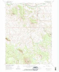
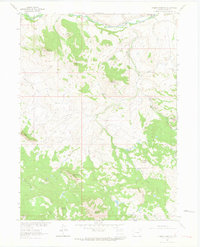
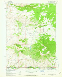
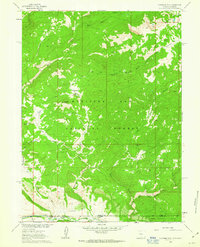
1962 Map of Tumble Mountain
USGS Topo · Published 1971About this map
The Little Snake River winds across the northern edge of this high-elevation landscape, anchoring a region of dramatic peaks and deep drainages. Mapping conducted for the Missouri River Basin project reveals a rugged ranching and mining environment in the early 1960s, where Focus Ranch and Maria Bottoms represent rare points of settlement in the valley. The terrain is dominated by a series of prominent summits, including the twin heights of West Gibraltar Peak and East Gibraltar Peak, along with Tumble Mountain and Columbus Mountain. Evidence of early resource extraction persists at Gold Blossom Rocks on the eastern slopes. A network of jeep trails provides the only access through the drainage systems of Cowling Creek and Willow Creek, illustrating the remote nature of this Colorado mountain terrain before modern development.
Find a feature on this map
27 named features on this map. Tap any name to fly to it.
Don’t see what you’re looking for? This feature index may not catch every label — zoom into the map to look around manually.
Map Details
Editions of this 1962 Tumble Mountain Map
3 editions found

Other maps of this area

1932 · Savery
USGS Topo · 1:96,000

1940 · Savery
USGS Topo · 1:125,000

1954 · Rawlins
USGS Topo · 1:250,000

1954 · Craig
USGS Topo · 1:250,000

1957 · Craig
USGS Topo · 1:250,000

1958 · Rawlins
USGS Topo · 1:250,000

1958 · Craig
USGS Topo · 1:250,000

1960 · Craig
USGS Topo · 1:250,000
1961 · Grieve Reservoir
USGS Topo · 1:24,000
1961 · Fletcher Peak
USGS Topo · 1:24,000