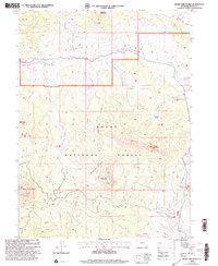
2000 Map of Bears Ears Peaks
USGS Topo · Published 2004About this map
Routt National Forest defines this high-altitude landscape in northern Colorado, where the Elkhead Trail and Bears Ears Trail navigate a complex network of ridges and drainage basins. The map captures a high density of administrative outposts, including the Grizzly Creek Guard Station, Adams Creek Guard Station, and Sawtooth Guard Station, marking the importance of this region for forest management and monitoring at the turn of the millennium.
Find a feature on this map
35 named features on this map. Tap any name to fly to it.
Don’t see what you’re looking for? This feature index may not catch every label — zoom into the map to look around manually.
Map Details
Editions of this 2000 Bears Ears Peaks Map
This is the sole edition of this map. No revisions or reprints were ever made.
Other maps of this area

1923 · Elkhead Creek
USGS Topo · 1:62,500

1923 · Pilot Knob
USGS Topo · 1:62,500

1924 · Elkhead Creek
USGS Topo · 1:62,500

1925 · Pilot Knob
USGS Topo · 1:62,500

1954 · Craig
USGS Topo · 1:250,000

1957 · Craig
USGS Topo · 1:250,000

1958 · Craig
USGS Topo · 1:250,000

1960 · Craig
USGS Topo · 1:250,000

1962 · Craig
USGS Topo · 1:250,000
1962 · Tumble Mountain
USGS Topo · 1:24,000