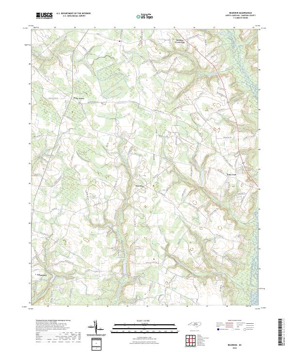
2022 Map of Bearskin
USGS Topo · Published 2022About this map
The agricultural heart of Sampson County is defined by a dense network of watercourses and family crossroads in this modern survey. The landscape is structured by the winding paths of Old Mill Swamp, Marsh Swamp, and Hornet Swamp, which drain into the larger Great Coharie Cr along the eastern edge. Small settlements such as Beaman Crossroads and Kitty Fork serve as focal points for the rural community, connected by roads that often bear the names of local families and historic landmarks, such as Parker Memorial Rd and Penny Tew Mill Rd.
Find a feature on this map
95 named features on this map. Tap any name to fly to it.
Don’t see what you’re looking for? This feature index may not catch every label — zoom into the map to look around manually.
Map Details
Editions of this 2022 Bearskin Map
This is the sole edition of this map. No revisions or reprints were ever made.
Other maps of this area

1909 · Coharie
USGS Topo · 1:62,500

1953 · Florence
USGS Topo · 1:250,000

1953 · Raleigh
USGS Topo · 1:250,000

1954 · Florence
USGS Topo · 1:250,000

1954 · Raleigh
USGS Topo · 1:250,000

1959 · Roseboro
USGS Topo · 1:62,500

1959 · Garland
USGS Topo · 1:62,500

1974 · Salemburg
USGS Topo · 1:24,000
1974 · Mingo
USGS Topo · 1:24,000

1982 · Elizabethtown
USGS Topo · 1:100,000