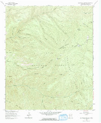
1963 Map of Bearwallow Mountain
USGS Topo · Published 1965About this map
Gila National Forest encompasses the high-altitude terrain of the Mogollon Mountains as they stood in the early 1960s. This survey, based on 1958 aerial photography, highlights a landscape of deep drainages and volcanic peaks centered around the 9,953-foot summit of Bearwallow Mountain. The map illustrates the administrative and early ranching history of Catron County, noting the Old Waterman Place and a Trailer Cabin tucked along Mineral Creek.
Find a feature on this map
45 named features on this map. Tap any name to fly to it.
Don’t see what you’re looking for? This feature index may not catch every label — zoom into the map to look around manually.
Map Details
Editions of this 1963 Bearwallow Mountain Map
2 editions found
Other maps of this area

1910 · Mogollon
USGS Topo · 1:125,000

1912 · Mogollon
USGS Topo · 1:125,000

1915 · Reserve
USGS Topo · 1:125,000

1918 · Reserve
USGS Topo · 1:125,000

1954 · Clifton
USGS Topo · 1:250,000

1957 · Clifton
USGS Topo · 1:250,000

1958 · Clifton
USGS Topo · 1:250,000

1962 · Clifton
USGS Topo · 1:250,000

1963 · Bearwallow Mountain
USGS Topo · 1:24,000

1963 · Negrito Mountain
USGS Topo · 1:24,000