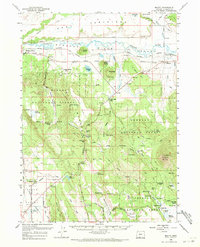
1960 Map of Beatty
USGS Topo · Published 1971About this map
The Klamath Indian Reservation Boundary cuts across this high-desert landscape, preserving the location of significant cultural and historical sites. Prominent among these are the Paiute Cem, Jackson Cem, and the Chief Schonchin Cem, alongside the former Yainax Agency (Site). The geography is defined by the broad Sprague River valley and its surrounding highlands, including Council Butte and the volcanic prominence of Yainax Butte.
Find a feature on this map
66 named features on this map. Tap any name to fly to it.
Don’t see what you’re looking for? This feature index may not catch every label — zoom into the map to look around manually.
Map Details
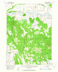
Editions of this 1960 Beatty Map
3 editions found

Other maps of this area

1889 · Klamath
USGS Topo · 1:250,000

1894 · Klamath
USGS Topo · 1:250,000

1955 · Klamath Falls
USGS Topo · 1:250,000

1956 · Calimus Butte
USGS Topo · 1:62,500

1957 · Merrill
USGS Topo · 1:62,500

1957 · Swan Lake
USGS Topo · 1:62,500

1957 · Malin
USGS Topo · 1:62,500

1958 · Klamath Falls
USGS Topo · 1:250,000

1960 · Gerber Reservoir
USGS Topo · 1:62,500

1960 · Riverbed Butte
USGS Topo · 1:62,500