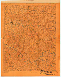
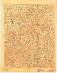
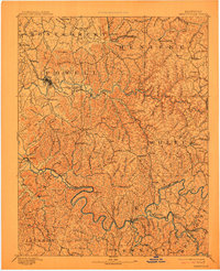
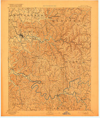
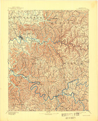
1892 Map of Beattyville
USGS Topo · Published 1892This historical map portrays the area of Beattyville in 1892, primarily covering Lee County as well as portions of Estill County, Morgan County, Breathitt County, Powell County, Jackson County, Bath County, Clark County, Montgomery County, Wolfe County, Menifee County, and Owsley County. Featuring a scale of 1:125000, this map provides a highly detailed snapshot of the terrain, roads, buildings, counties, and historical landmarks in the Beattyville region at the time. Published in 1892, it is one of 6 known editions of this map due to revisions or reprints.
Find a feature on this map
115 named features on this map. Tap any name to fly to it.
Don’t see what you’re looking for? This feature index may not catch every label — zoom into the map to look around manually.
Map Details
Editions of this 1892 Beattyville Map
6 editions found
Historical Maps of North Irvine Through Time
3 maps found