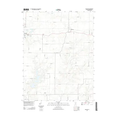
2015 Map of Beaucoup
USGS Topo · Published 2015About this map
The city of Nashville serves as a primary hub on this Illinois landscape, situated near the Nashville City Reservoir and Nashville Cr. This modern 2015 survey reveals a dense network of rural roads named for distant states, such as Alabama Rd, Oregon Rd, and Mississippi Rd, which crisscross the agricultural terrain. To the east, the small settlement of Beaucoup is positioned along the creek of the same name, while the southern reaches of the map are defined by the expansive Washington County Lake and the community of Posen. For those researching family history, the map provides precise locations for numerous burial grounds including Saint Anns Catholic Cem, Greenwood Cem, and the Old County Cem. The drainage patterns are well-defined by Sugar Cr, Back Cr, and Hickory Cr, which move through the fields and wooded areas surrounding these established communities.
Find a feature on this map
60 named features on this map. Tap any name to fly to it.
Don’t see what you’re looking for? This feature index may not catch every label — zoom into the map to look around manually.
Map Details
Editions of this 2015 Beaucoup Map
This is the sole edition of this map. No revisions or reprints were ever made.
Other maps of this area

1924 · Pinckneyville
USGS Topo · 1:62,500

1926 · Pinckneyville
USGS Topo · 1:62,500

1926 · Duquoin
USGS Topo · 1:62,500

1931 · Hoyleton
USGS Topo · 1:48,000

1932 · Nashville
USGS Topo · 1:62,500

1936 · Nashville
USGS Topo · 1:62,500

1943 · Ashley
USGS Topo · 1:62,500

1946 · Ashley
USGS Topo · 1:62,500

1958 · Belleville
USGS Topo · 1:250,000

1962 · Belleville
USGS Topo · 1:250,000