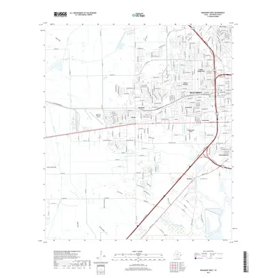
2019 Map of Beaumont West
USGS Topo · Published 2019About this map
Beaumont and its western suburbs show a landscape defined by an intricate network of waterways and modern infrastructure in the late 2010s. The Lower Neches Valley Authority Canal and the B-1 Canal reflect the engineered water management critical to this coastal prairie region. Residential expansion is evident in neighborhoods like Caldwood Acres, Calder Highlands, and Sunnyside, which sit alongside established transit hubs like the Beaumont Municipal Airport. For genealogists, the Hebert Cem near Walden provides a specific point of local historical interest. The natural drainage of the land is visible through named features such as Willow Marsh Bayou and Hillebrandt Bayou, which wind through the developed areas near Elizabeth and Amelia, illustrating the persistent reach of the Gulf Coast's bayou system into the city's suburban footprint.
Find a feature on this map
116 named features on this map. Tap any name to fly to it.
Don’t see what you’re looking for? This feature index may not catch every label — zoom into the map to look around manually.
Map Details
Editions of this 2019 Beaumont West Map
This is the sole edition of this map. No revisions or reprints were ever made.
Other maps of this area

1926 · Lakeview
USGS Topo · 1:24,000

1926 · Vidor
USGS Topo · 1:24,000

1932 · Beaumont
USGS Topo · 1:62,500

1943 · Fannett East
USGS Topo · 1:24,000

1943 · Beaumont East
USGS Topo · 1:24,000

1945 · Fannett East
USGS Topo · 1:31,680

1950 · Houston
USGS Topo · 1:250,000

1954 · Beaumont
USGS Topo · 1:250,000

1955 · Sour Lake
USGS Topo · 1:62,500

1956 · Houston
USGS Topo · 1:250,000