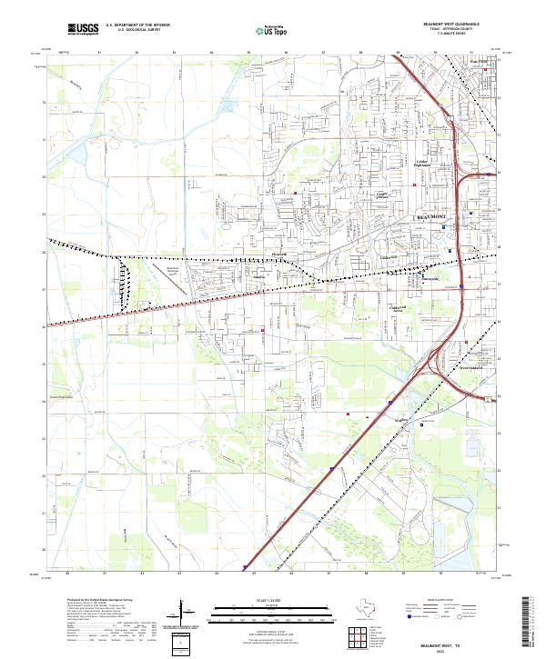
2022 Map of Beaumont West
USGS Topo · Published 2022About this map
The western suburbs of Beaumont and the industrial-residential corridors of Jefferson County are captured here in the early 2020s. This landscape is defined by its complex drainage network, where natural waterways like Hillebrandt Bayou and Willow Marsh Bayou navigate between engineered water systems including the Lower Neches Valley Authority Canal and the Bi Canal. The settlement pattern reflects mid-to-late 20th-century expansion, with established neighborhoods such as Amelia, Sunnyside, and Calder Highlands bordering the aviation activity of the Beaumont Municipal Airport. For genealogists and local historians, the map preserves the location of Prater Cem in the north and Herbert Cem near Walden, providing vital spatial context for family research in this rapidly developing Gulf Coast region. The infrastructure is anchored by the Eastex Fwy and Homsar Pointe Blvd, illustrating the modern transportation framework of the Texas coastal plain.
Find a feature on this map
247 named features on this map. Tap any name to fly to it.
Don’t see what you’re looking for? This feature index may not catch every label — zoom into the map to look around manually.
Map Details
Editions of this 2022 Beaumont West Map
This is the sole edition of this map. No revisions or reprints were ever made.
Other maps of this area

1926 · Lakeview
USGS Topo · 1:24,000

1926 · Vidor
USGS Topo · 1:24,000

1932 · Beaumont
USGS Topo · 1:62,500

1943 · Fannett East
USGS Topo · 1:24,000

1943 · Beaumont East
USGS Topo · 1:24,000

1945 · Fannett East
USGS Topo · 1:31,680

1950 · Houston
USGS Topo · 1:250,000

1954 · Beaumont
USGS Topo · 1:250,000

1955 · Sour Lake
USGS Topo · 1:62,500

1956 · Houston
USGS Topo · 1:250,000