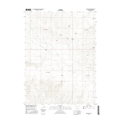
2016 Map of Beaver Basin
USGS Topo · Published 2016About this map
Beaver Basin serves as a central drainage point in this high-elevation landscape of Moffat County, where the hydrology is defined by a network of seasonal and permanent water sources like Cottonwood Springs and Rocky Reservoir. The terrain is characterized by prominent high points including Bishop Peak, Mid Mtn, and the expansive Cold Spring Mtn to the south. Land use in this northwestern Colorado region is reflected in the naming of topographical features after local figures or natural characteristics, such as Birdie Gulch, Johnson Flats, and Elk Meadow. Transportation through this isolated country is maintained by Co RD 72 and Co RD 71, which navigate the draws and peaks of the t11n r103w and surrounding townships. Numerous springs, such as Spitzie Spring and Morales Spring, indicate the vital importance of water access for livestock and local wildlife in the high desert environment.
Find a feature on this map
35 named features on this map. Tap any name to fly to it.
Don’t see what you’re looking for? This feature index may not catch every label — zoom into the map to look around manually.
Map Details
Editions of this 2016 Beaver Basin Map
This is the sole edition of this map. No revisions or reprints were ever made.
Other maps of this area

1885 · Ashley
USGS Topo · 1:250,000

1952 · Willow Creek Butte
USGS Topo · 1:24,000

1952 · Swallow Canyon
USGS Topo · 1:24,000

1954 · Lodore School
USGS Topo · 1:24,000

1954 · Vernal
USGS Topo · 1:250,000

1954 · Rock Springs
USGS Topo · 1:250,000

1958 · Vernal
USGS Topo · 1:250,000

1958 · Rock Springs
USGS Topo · 1:250,000

1960 · Vernal
USGS Topo · 1:250,000

1962 · Rock Springs
USGS Topo · 1:250,000