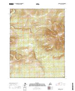
2017 Map of Beaver C-4 SW
USGS Topo · Published 2017About this map
Lone Mountain stands as a prominent elevation in this interior Alaskan landscape, which is defined by an intricate network of ridgelines and drainage systems. The survey area, mapped in 2017, focuses on the upper reaches and headwaters of the Mud Fork, where the terrain transitions from high slopes into the valley floor. This specific quadrant is characterized by its high-altitude topography, illustrating the complex watershed patterns that feed into the larger Yukon-Koyukuk drainage systems. The map provides a detailed view of the township and range boundaries including t21n r7w and t20n r6w, documenting the land divisions of this remote interior region during the early twenty-first century.
Find a feature on this map
8 named features on this map. Tap any name to fly to it.
Don’t see what you’re looking for? This feature index may not catch every label — zoom into the map to look around manually.
Map Details
Editions of this 2017 Beaver C-4 SW Map
This is the sole edition of this map. No revisions or reprints were ever made.
Other maps of this area

1951 · Beaver
USGS Topo · 1:250,000

1956 · Beaver B-5
USGS Topo · 1:63,360

1956 · Beaver
USGS Topo · 1:250,000

1956 · Beaver B-4
USGS Topo · 1:63,360

1964 · Beaver
USGS Topo · 1:250,000
1970 · Beaver C-5
USGS Topo · 1:63,360
1970 · Beaver C-4
USGS Topo · 1:63,360
2017 · Beaver C-5 NE
USGS Topo · 1:25,000
2017 · Beaver C-5 SE
USGS Topo · 1:25,000
2017 · Beaver C-4 NW
USGS Topo · 1:25,000