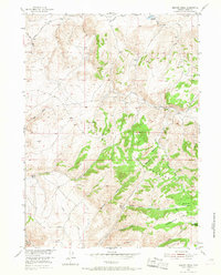
1953 Map of Beaver Creek
USGS Topo · Published 1967About this map
The Shirley Mountains dominate this high-elevation landscape of Carbon County, where the transition from the Shirley Basin floor leads into a complex network of canyons and meadows. Surveyed in the early 1950s as part of the Missouri River Basin development program, the area shows clear signs of its ranching history and the challenges of high-country settlement. Several sites are explicitly noted as uninhabited, including Tikkmen Ranch (Abandoned) near Lost Creek and Salmi Ranch (Abandoned) along the banks of Johnson Canyon.
Find a feature on this map
24 named features on this map. Tap any name to fly to it.
Don’t see what you’re looking for? This feature index may not catch every label — zoom into the map to look around manually.
Map Details
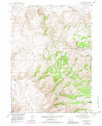
Editions of this 1953 Beaver Creek Map
3 editions found
Other maps of this area

1953 · Leo
USGS Topo · 1:24,000

1953 · Seminoe Dam NE
USGS Topo · 1:24,000

1953 · Seminoe Dam SE
USGS Topo · 1:24,000

1953 · Fourmile Point
USGS Topo · 1:24,000

1953 · Fourmile Ridge
USGS Topo · 1:24,000

1953 · Schneider Ridge
USGS Topo · 1:24,000

1953 · The Q Ranch
USGS Topo · 1:24,000

1953 · T E Ranch
USGS Topo · 1:24,000

1953 · Beaver Creek
USGS Topo · 1:24,000

1955 · Casper
USGS Topo · 1:250,000