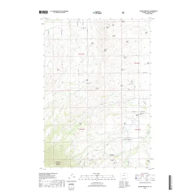
2018 Map of Beaver Creek Hills
USGS Topo · Published 2018About this map
The Bighorn National Forest boundary marks the southwest corner of this landscape, where the terrain descends into a complex network of draws and man-made waterways. The presence of the Big Goose and Beaver Ditch, Peralta Ditch, and Colorado Colony Ditch indicates a highly managed hydrological system designed to move water across the Beaver Creek Hills for agricultural or ranching use.
Find a feature on this map
72 named features on this map. Tap any name to fly to it.
Don’t see what you’re looking for? This feature index may not catch every label — zoom into the map to look around manually.
Map Details
Editions of this 2018 Beaver Creek Hills Map
This is the sole edition of this map. No revisions or reprints were ever made.
Other maps of this area

1895 · Dayton
USGS Topo · 1:125,000

1901 · Dayton
USGS Topo · 1:125,000

1909 · Sheridan
USGS Topo · 1:125,000

1911 · Sheridan
USGS Topo · 1:125,000

1955 · Sheridan
USGS Topo · 1:250,000

1958 · Sheridan
USGS Topo · 1:250,000

1962 · Sheridan
USGS Topo · 1:250,000

1964 · Wolf
USGS Topo · 1:24,000

1964 · Beckton
USGS Topo · 1:24,000
1964 · Hultz Draw
USGS Topo · 1:24,000