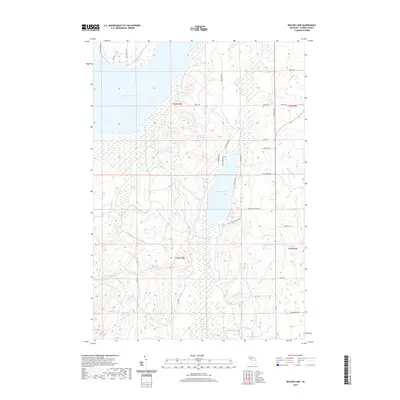
2019 Map of Beaver Lake
USGS Topo · Published 2019About this map
Beaver Lake and the expansive Fletcher Pond dominate this portion of Alpena County, illustrating a landscape defined by significant water management and glacial hydrology. The pond, along with creek systems like Butterfield Cr and Rayburn Cr, reflects the interior wetland character of Ossineke Township. Local history and genealogy researchers will find Spratt Cem located along Spratt Rd, a primary east-west artery connecting the rural homesteads of the area. The road network, including family-named routes such as Meinzinger Rd, Cousineau Rd, and Clewley Rd, reveals a modern settlement pattern built upon older agricultural and timbering divisions. The survey also documents recreational access points like Beaver Lake Park Rd and Emils Landing Rd, highlighting the transition from traditional land use to contemporary residential and seasonal lakeside living.
Find a feature on this map
32 named features on this map. Tap any name to fly to it.
Don’t see what you’re looking for? This feature index may not catch every label — zoom into the map to look around manually.
Map Details
Editions of this 2019 Beaver Lake Map
This is the sole edition of this map. No revisions or reprints were ever made.
Other maps of this area

1954 · Tawas City
USGS Topo · 1:250,000

1954 · Alpena
USGS Topo · 1:250,000

1955 · Hillman
USGS Topo · 1:62,500

1957 · Alpena
USGS Topo · 1:250,000

1958 · Alpena
USGS Topo · 1:250,000

1958 · Tawas City
USGS Topo · 1:250,000

1969 · Alpena
USGS Topo · 1:250,000

1971 · Lachine
USGS Topo · 1:24,000

1972 · McCollum Lake
USGS Topo · 1:24,000

1972 · Hubbard Lake SW
USGS Topo · 1:24,000