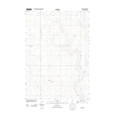
2013 Map of Bechyn
USGS Topo · Published 2013About this map
Bechyn sits within a landscape defined by an extensive network of water management in Renville County. This survey reveals a highly organized agricultural grid where natural waterways like the W Fork Beaver Cr and E Fork Beaver Cr are supplemented by numbered engineering projects such as County Ditch Number Seventy-nine and County Ditch Number One Hundred Ten. These drainage systems are essential to the productivity of the surrounding farmland, guiding water toward the main channel of Beaver Cr.
Find a feature on this map
25 named features on this map. Tap any name to fly to it.
Don’t see what you’re looking for? This feature index may not catch every label — zoom into the map to look around manually.
Map Details
Editions of this 2013 Bechyn Map
This is the sole edition of this map. No revisions or reprints were ever made.
Other maps of this area

1952 · Morton
USGS Topo · 1:62,500

1952 · Redwood Falls
USGS Topo · 1:62,500

1953 · New Ulm
USGS Topo · 1:250,000

1957 · New Ulm
USGS Topo · 1:250,000

1957 · Olivia
USGS Topo · 1:62,500

1958 · New Ulm
USGS Topo · 1:250,000

1965 · Danube
USGS Topo · 1:24,000

1965 · Renville
USGS Topo · 1:24,000

1967 · New Ulm
USGS Topo · 1:250,000
1982 · Vicksburg
USGS Topo · 1:24,000