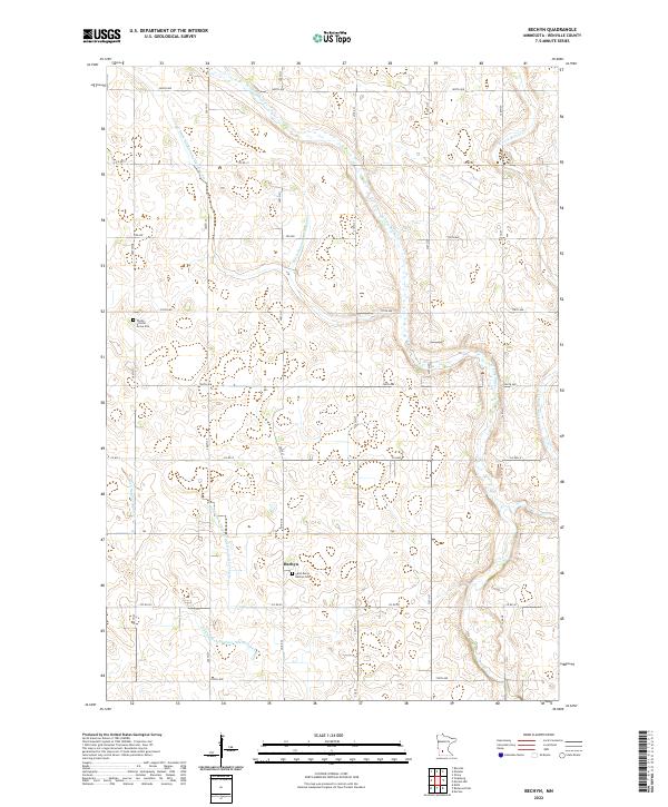
2022 Map of Bechyn
USGS Topo · Published 2022About this map
Bechyn serves as a small, central node within a vast agricultural landscape in Renville County. The terrain is defined by a sophisticated system of engineered waterways, including County Ditch Number One Hundred Ten and County Ditch Number One Hundred Thirty, which crisscross the prairie to manage the watershed feeding into the W Fork Beaver Cr and E Fork Beaver Cr. These drainage ditches reveal the intentional modification of the Minnesota landscape to support large-scale farming.
Find a feature on this map
27 named features on this map. Tap any name to fly to it.
Don’t see what you’re looking for? This feature index may not catch every label — zoom into the map to look around manually.
Map Details
Editions of this 2022 Bechyn Map
This is the sole edition of this map. No revisions or reprints were ever made.
Other maps of this area

1952 · Morton
USGS Topo · 1:62,500

1952 · Redwood Falls
USGS Topo · 1:62,500

1953 · New Ulm
USGS Topo · 1:250,000

1957 · New Ulm
USGS Topo · 1:250,000

1957 · Olivia
USGS Topo · 1:62,500

1958 · New Ulm
USGS Topo · 1:250,000

1965 · Danube
USGS Topo · 1:24,000

1965 · Renville
USGS Topo · 1:24,000

1967 · New Ulm
USGS Topo · 1:250,000
1982 · Vicksburg
USGS Topo · 1:24,000