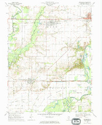
1969 Map of Beckemeyer
USGS Topo · Published 1971About this map
Beckemeyer and Bartelso anchor this mid-century look at Clinton County, where the agricultural landscape meets the active petroleum and transportation industries of Southern Illinois. The map documents an extensive rail network, with the Baltimore and Ohio and Southern lines cutting east-west across a terrain defined by the winding Kaskaskia River and its associated bottomlands. The presence of the Bartelso Oil Field and the Germantown East Oil Field illustrates the region's reliance on mineral extraction, while the numerous family and parish burial grounds, such as St Anthonys Cem and Maddux Cem, provide essential data for genealogical research.
Find a feature on this map
55 named features on this map. Tap any name to fly to it.
Don’t see what you’re looking for? This feature index may not catch every label — zoom into the map to look around manually.
Map Details
Editions of this 1969 Beckemeyer Map
This is the sole edition of this map. No revisions or reprints were ever made.
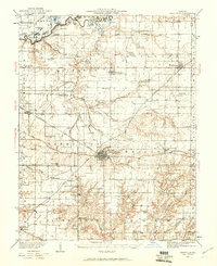
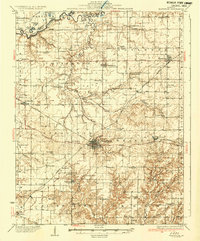
Other maps of this area

1906 · Breese
USGS Topo · 1:62,500

1907 · Breese
USGS Topo · 1:62,500

1910 · Carlyle
USGS Topo · 1:62,500

1910 · Okawville
USGS Topo · 1:62,500

1931 · Hoyleton
USGS Topo · 1:48,000
1932 · Nashville
USGS Topo · 1:62,500
1936 · Nashville
USGS Topo · 1:62,500

1940 · Okawville
USGS Topo · 1:62,500

1948 · Carlyle
USGS Topo · 1:62,500

1958 · Belleville
USGS Topo · 1:250,000