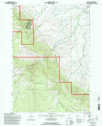
1993 Map of Beckton
USGS Topo · Published 1997About this map
The settlement of Beckton and the surrounding foothills of the Big Horn Mountains define this landscape in the early 1990s. This territory is heavily shaped by the management of water resources, most notably at the Sheridan Filtration Plant and a nearby Gaging Sta along the drainages of Big Goose Creek. A Historical Marker near the northern boundary suggests the area's significance beyond its modern utility, while the rugged transition from valley floor to forest is marked by family-named terrain like Walker Prairie and She-Bear Mountain.
Find a feature on this map
27 named features on this map. Tap any name to fly to it.
Don’t see what you’re looking for? This feature index may not catch every label — zoom into the map to look around manually.
Map Details
Editions of this 1993 Beckton Map
2 editions found
Other maps of this area

1895 · Dayton
USGS Topo · 1:125,000

1901 · Dayton
USGS Topo · 1:125,000

1955 · Sheridan
USGS Topo · 1:250,000

1958 · Sheridan
USGS Topo · 1:250,000

1962 · Sheridan
USGS Topo · 1:250,000

1964 · Wolf
USGS Topo · 1:24,000

1964 · Dayton South
USGS Topo · 1:24,000

1964 · Walker Mountain
USGS Topo · 1:24,000

1964 · Beckton
USGS Topo · 1:24,000
1964 · Dome Lake
USGS Topo · 1:24,000