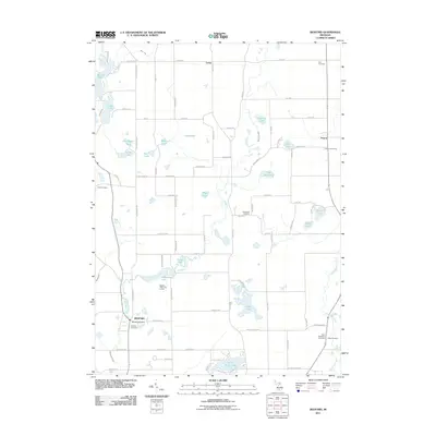
2011 Map of Bedford
USGS Topo · Published 2011About this map
The settlement of Bedford serves as the focal point of this southwestern Michigan landscape, featuring the Bedford Post Office and Bedford Cemetery near the banks of Wabacon Creek. The geography is defined by its numerous kettle lakes and wetland systems, ranging from the larger waters of Wabascon Lake and Saint Marys Lake to smaller named bodies like Loon Lake and Grass Lake. This 2011 survey captures a rural environment where agricultural road grids are punctuated by significant local history sites. Genealogists will find a high density of burial grounds throughout the area, including the Checkered Cemetery near the center of the sheet and the Assyria Cemetery to the east. The terrain transitions from the residential clusters in the south to the more dispersed hamlets of Lacey and Assyria further north.
Find a feature on this map
67 named features on this map. Tap any name to fly to it.
Don’t see what you’re looking for? This feature index may not catch every label — zoom into the map to look around manually.
Map Details
Editions of this 2011 Bedford Map
This is the sole edition of this map. No revisions or reprints were ever made.
Other maps of this area

1918 · Battle Creek
USGS Topo · 1:62,500

1918 · Galesburg
USGS Topo · 1:62,500

1943 · Battle Creek
USGS Topo · 1:62,500

1944 · Galesburg
USGS Topo · 1:62,500

1947 · Augusta
USGS Topo · 1:24,000

1947 · Banfield
USGS Topo · 1:24,000

1947 · Bellevue
USGS Topo · 1:24,000

1947 · Bedford
USGS Topo · 1:24,000

1947 · Ceresco
USGS Topo · 1:24,000

1947 · Battle Creek
USGS Topo · 1:24,000