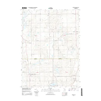
2014 Map of Bedford
USGS Topo · Published 2014About this map
Glacial topography and rural crossroads define this landscape along the border of Barry and Calhoun Counties. The settlement of Bedford anchors the southwestern corner, while Lacey serves as a northern hub for the surrounding agricultural community. The terrain is notably pocketed with numerous lakes and wetlands, including the larger Bristol Lake in the northwest and Saint Marys Lake at the southern margin. This survey highlights an intricate network of local cemeteries, such as the Checkered Cem and Ellis Cem, which offer significant value for genealogists tracing family histories in the township. Smaller water bodies like Von Syckle Lake and Cassidy Lake are connected by drainage systems including Wabascon Creek, reflecting the natural drainage patterns of this lake-strewn Michigan interior. The map documents the persistent rural character of the region, where family-named roads and scattered farmsteads remain the primary structural elements.
Find a feature on this map
101 named features on this map. Tap any name to fly to it.
Don’t see what you’re looking for? This feature index may not catch every label — zoom into the map to look around manually.
Map Details
Editions of this 2014 Bedford Map
This is the sole edition of this map. No revisions or reprints were ever made.
Other maps of this area

1918 · Battle Creek
USGS Topo · 1:62,500

1918 · Galesburg
USGS Topo · 1:62,500

1943 · Battle Creek
USGS Topo · 1:62,500

1944 · Galesburg
USGS Topo · 1:62,500

1947 · Augusta
USGS Topo · 1:24,000

1947 · Banfield
USGS Topo · 1:24,000

1947 · Bellevue
USGS Topo · 1:24,000

1947 · Bedford
USGS Topo · 1:24,000

1947 · Ceresco
USGS Topo · 1:24,000

1947 · Battle Creek
USGS Topo · 1:24,000