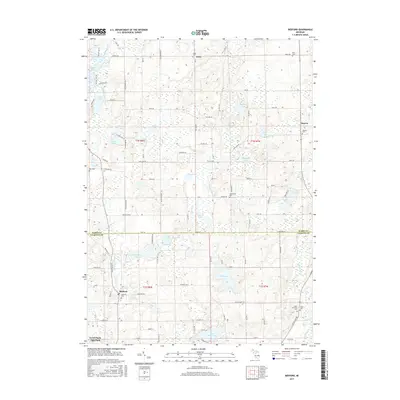
2017 Map of Bedford
USGS Topo · Published 2017About this map
Bedford and Assyria anchor this 2017 study of the rural borderlands between Barry and Calhoun Counties. The landscape is defined by a dense concentration of kettle lakes and wetlands, including Bristol Lake, Saint Marys Lake, and the expansive Wabason Lake. These water bodies are connected by a network of small drainages like Wabason Creek and Wanadoga Cr, which navigate the undulating glacial topography. The settlement pattern remains largely agricultural, punctuated by numerous small cemeteries that serve as vital landmarks for local history and genealogy. Notable sites such as Checkered Cem, Iden Cem, and Ellis Cem are scattered across the townships, often positioned near historic crossroads like Lacey. The map documents a quiet, water-rich region where legacy family names are preserved on rural routes like Hutchinson Rd and S Schreiner Rd, maintaining a character distinct from the more developed areas to the south.
Find a feature on this map
102 named features on this map. Tap any name to fly to it.
Don’t see what you’re looking for? This feature index may not catch every label — zoom into the map to look around manually.
Map Details
Editions of this 2017 Bedford Map
This is the sole edition of this map. No revisions or reprints were ever made.
Other maps of this area

1918 · Battle Creek
USGS Topo · 1:62,500

1918 · Galesburg
USGS Topo · 1:62,500

1943 · Battle Creek
USGS Topo · 1:62,500

1944 · Galesburg
USGS Topo · 1:62,500

1947 · Augusta
USGS Topo · 1:24,000

1947 · Banfield
USGS Topo · 1:24,000

1947 · Bellevue
USGS Topo · 1:24,000

1947 · Bedford
USGS Topo · 1:24,000

1947 · Ceresco
USGS Topo · 1:24,000

1947 · Battle Creek
USGS Topo · 1:24,000