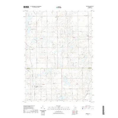
2019 Map of Bedford
USGS Topo · Published 2019About this map
Lacey and Assyria are the primary hubs of this landscape, situated along the border of Barry and Calhoun Counties. The terrain is defined by a dense network of glacial water bodies, ranging from the prominent Saint Marys Lake in the south to Cassidy Lake and Von Syckle Lake in the north. This region reveals a well-developed grid of local roads, such as North Ave and Case Rd, which connect the small settlements to various rural landmarks. Numerous family and community burial grounds are found throughout the townships, including Checkered Cem, Iden Cem, and Ellis Cem. The intricate hydrology is further marked by several streams like Wabasco Creek and Spring Brook, which weave through the wetlands and rolling hills characteristic of this part of southern Michigan.
Find a feature on this map
102 named features on this map. Tap any name to fly to it.
Don’t see what you’re looking for? This feature index may not catch every label — zoom into the map to look around manually.
Map Details
Editions of this 2019 Bedford Map
This is the sole edition of this map. No revisions or reprints were ever made.
Other maps of this area

1918 · Battle Creek
USGS Topo · 1:62,500

1918 · Galesburg
USGS Topo · 1:62,500

1943 · Battle Creek
USGS Topo · 1:62,500

1944 · Galesburg
USGS Topo · 1:62,500

1947 · Augusta
USGS Topo · 1:24,000

1947 · Banfield
USGS Topo · 1:24,000

1947 · Bellevue
USGS Topo · 1:24,000

1947 · Bedford
USGS Topo · 1:24,000

1947 · Ceresco
USGS Topo · 1:24,000

1947 · Battle Creek
USGS Topo · 1:24,000