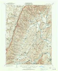
1908 Map of Bedford
USGS Topo · Published 1958About this map
The Allegheny Mountains define the western reaches of this 1908 survey, where the rugged terrain of Pot Ridge and Allegheny Ridge gives way to a network of valleys supporting small agricultural and milling communities. Local commerce is centered around water-powered sites such as Ryan Mill and the dual-named post offices of Mowrys Mills Weyant PO and Pleasantville Alumbank PO, reflecting the importance of both industry and communication in the early 20th century.
Find a feature on this map
86 named features on this map. Tap any name to fly to it.
Don’t see what you’re looking for? This feature index may not catch every label — zoom into the map to look around manually.
Map Details
Editions of this 1908 Bedford Map
This is the sole edition of this map. No revisions or reprints were ever made.
Other maps of this area
1900 · Everett
USGS Topo · 1:62,500
1902 · Everett
USGS Topo · 1:62,500
1902 · Ebensburg
USGS Topo · 1:62,500
1902 · Hollidaysburg
USGS Topo · 1:62,500
1903 · Hollidaysburg
USGS Topo · 1:62,500
1904 · Ebensburg
USGS Topo · 1:62,500
1904 · Johnstown
USGS Topo · 1:62,500
1907 · Johnstown
USGS Topo · 1:62,500
1910 · Bedford
USGS Topo · 1:62,500
1914 · Windber
USGS Topo · 1:62,500