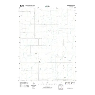
2010 Map of Bedford SW
USGS Topo · Published 2010About this map
Allison stands as the primary settlement hub in this rural landscape near the Missouri-Iowa border, supported by the Allison Post Office as a local community center. The terrain is defined by a dense network of drainages including Honey Creek, Norvey Creek, and Brushy Creek, which carve through the agricultural tablelands. The map reveals a high concentration of small, dispersed burial grounds such as Ross Township Cemetery, Kemery Cemetery, and New Hope Cemetery, which often signify the locations of early family homesteads or vanished rural congregations. Water management for local agriculture or recreation is evident through features like Allen Lake and James Lake, both secured by their respective dams. The orderly grid of county roads, including Missouri-Taylor St and County Line Rd, facilitates movement across this agrarian corridor where the landscape remains largely dedicated to farming and small-town life.
Find a feature on this map
42 named features on this map. Tap any name to fly to it.
Don’t see what you’re looking for? This feature index may not catch every label — zoom into the map to look around manually.
Map Details
Editions of this 2010 Bedford SW Map
This is the sole edition of this map. No revisions or reprints were ever made.
Other maps of this area

1940 · Bedford
USGS Topo · 1:62,500

1940 · New Market
USGS Topo · 1:62,500

1940 · Parnell
USGS Topo · 1:62,500

1943 · Bedford
USGS Topo · 1:62,500

1943 · Parnell
USGS Topo · 1:62,500

1943 · Maryville
USGS Topo · 1:62,500

1943 · New Market
USGS Topo · 1:62,500

1955 · Nebraska City
USGS Topo · 1:250,000

1957 · Nebraska City
USGS Topo · 1:250,000

1958 · Nebraska City
USGS Topo · 1:250,000