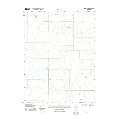
2011 Map of Bedford SW
USGS Topo · Published 2011About this map
Allison and its corresponding Allison Post Office serve as the central hub of this agricultural landscape in Independence Township during the early 21st century. The terrain is defined by a dense network of watercourses, including Honey Creek, Brushy Creek, and Norvey Creek, which carve through the grid-like system of rural roads such as State Hwy E and Orion Rd. This survey provides a detailed look at the distribution of community anchors, notably several well-preserved burial grounds that reflect the area's genealogical history, from Ross Township Cemetery in the northwest to Brethren Cemetery in the south. Land use is further characterized by water management features like the James Lake Dam and Allen Lake, highlighting the enduring importance of local drainage and reservoir systems to the regional economy and residents.
Find a feature on this map
43 named features on this map. Tap any name to fly to it.
Don’t see what you’re looking for? This feature index may not catch every label — zoom into the map to look around manually.
Map Details
Editions of this 2011 Bedford SW Map
This is the sole edition of this map. No revisions or reprints were ever made.
Other maps of this area

1940 · Bedford
USGS Topo · 1:62,500

1940 · New Market
USGS Topo · 1:62,500

1940 · Parnell
USGS Topo · 1:62,500

1943 · Bedford
USGS Topo · 1:62,500

1943 · Parnell
USGS Topo · 1:62,500

1943 · Maryville
USGS Topo · 1:62,500

1943 · New Market
USGS Topo · 1:62,500

1955 · Nebraska City
USGS Topo · 1:250,000

1957 · Nebraska City
USGS Topo · 1:250,000

1958 · Nebraska City
USGS Topo · 1:250,000