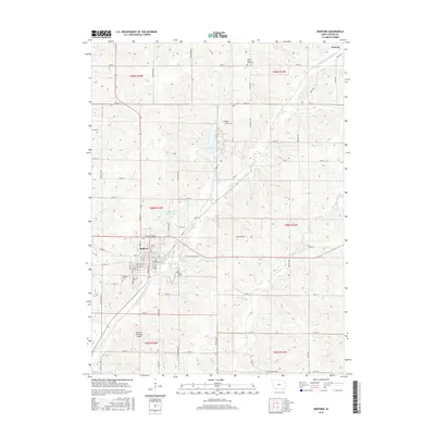
2015 Map of Bedford
USGS Topo · Published 2015About this map
Bedford serves as the central hub of this Iowa landscape, where a dense grid of streets like Main St and Pollock Blvd meets the agricultural expanse of Taylor County. The town is flanked by essential community sites, including the Bedford Municipal Airport to the south and a cluster of burial grounds such as Bedford Cem, Fairview Cem, and Mohler Cem. North of the town center, the Bedford Water Supply Lake and the larger Lake of Three Fires are prominent features, the latter surrounded by a network of rural routes including Lake Rd. The drainage of the E Fork One Hundred and Two River and its tributaries like Honey Cr and Daugherty Cr dictates the local topography. In the northeast corner, the small settlement of Conway marks the crossing of Quail Rd, while rural history is preserved at the Lexington Cem and Taylor County Farm Cem.
Find a feature on this map
58 named features on this map. Tap any name to fly to it.
Don’t see what you’re looking for? This feature index may not catch every label — zoom into the map to look around manually.
Map Details
Editions of this 2015 Bedford Map
This is the sole edition of this map. No revisions or reprints were ever made.
Other maps of this area

1940 · Bedford
USGS Topo · 1:62,500

1940 · New Market
USGS Topo · 1:62,500

1943 · Bedford
USGS Topo · 1:62,500

1943 · New Market
USGS Topo · 1:62,500

1955 · Nebraska City
USGS Topo · 1:250,000

1957 · Nebraska City
USGS Topo · 1:250,000

1958 · Nebraska City
USGS Topo · 1:250,000

1980 · Gravity
USGS Topo · 1:24,000

1980 · Merle Junction
USGS Topo · 1:24,000

1980 · Guss
USGS Topo · 1:24,000