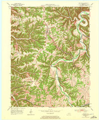
1953 Map of Bedford
USGS Topo · Published 1972About this map
The ridge-and-valley landscape of the northern Kentucky bluegrass region is defined here by the winding course of the Little Kentucky River. Centered on the town of Bedford, the map illustrates a rural interior where steep wooded slopes like Poplar Ridge and Morton Ridge separate deep drainage basins. This 1950s survey captures the region’s agricultural character, dotted with remote family burial grounds such as Ball Cem and local congregations at Hickory Grove Ch and Antioch Ch.
Find a feature on this map
32 named features on this map. Tap any name to fly to it.
Don’t see what you’re looking for? This feature index may not catch every label — zoom into the map to look around manually.
Map Details
Editions of this 1953 Bedford Map
3 editions found

Other maps of this area

1928 · New Castle
USGS Topo · 1:48,000

1932 · New Castle
USGS Topo · 1:62,500

1932 · La Grange
USGS Topo · 1:62,500

1939 · Bethlehem
USGS Topo · 1:24,000

1939 · Madison West
USGS Topo · 1:24,000

1943 · Brooksburg
USGS Topo · 1:24,000

1948 · Bethlehem
USGS Topo · 1:24,000

1948 · Madison West
USGS Topo · 1:24,000

1952 · Campbellsburg
USGS Topo · 1:24,000

1953 · Madison West
USGS Topo · 1:24,000