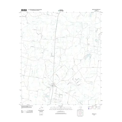
2013 Map of Bedias
USGS Topo · Published 2013About this map
Bedias anchors this portion of Grimes County, situated at the intersection of several farm-to-market roads and local routes like Main St and Leon St. The surrounding landscape is defined by an intricate network of waterways, most notably the winding courses of Bedias Creek and its southern branch, South Bedias Creek. These drainages, along with Kickapoo Creek and Iron Creek, create a dendritic pattern across the terrain, shaping the local geography around the small settlement of Cotton to the northeast. Several significant bodies of water, including Lake Bedias, Lake Wayne, and Lake Donna-V, are scattered through the area, indicating a mix of natural riparian zones and managed water resources. The road network, featuring named routes such as Dick Barnes Loop and Roy Hall Road, suggests a rural community where land ownership and access were closely tied to these persistent creek systems and small lakes.
Find a feature on this map
74 named features on this map. Tap any name to fly to it.
Don’t see what you’re looking for? This feature index may not catch every label — zoom into the map to look around manually.
Map Details
Editions of this 2013 Bedias Map
This is the sole edition of this map. No revisions or reprints were ever made.
Other maps of this area

1931 · Iola
USGS Topo · 1:62,500

1954 · Beaumont
USGS Topo · 1:250,000

1954 · Austin
USGS Topo · 1:250,000

1956 · Carlos
USGS Topo · 1:62,500

1957 · Beaumont
USGS Topo · 1:250,000

1961 · Singleton
USGS Topo · 1:24,000

1962 · Keith
USGS Topo · 1:24,000

1962 · Connor
USGS Topo · 1:24,000

1963 · Bedias
USGS Topo · 1:24,000

1963 · Steep Branch
USGS Topo · 1:24,000