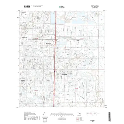
2021 Map of Bee Ridge
USGS Topo · Published 2021About this map
The residential and commercial corridors of eastern Sarasota are captured in high detail, showing the suburban expansion of communities like Bee Ridge and Sarasota Springs toward the interior of the county. The landscape is defined by its extensive water management system, featuring numerous artificial lakes and drainage features such as the Cow Pen Slough Canal and Philippe Creek. This late-era survey documents the dense subdivision of former agricultural lands into named neighborhoods like Pinecraft, The Meadows, and Sunnyland.
Find a feature on this map
45 named features on this map. Tap any name to fly to it.
Don’t see what you’re looking for? This feature index may not catch every label — zoom into the map to look around manually.
Map Details
Editions of this 2021 Bee Ridge Map
This is the sole edition of this map. No revisions or reprints were ever made.
Other maps of this area

1943 · Laurel
USGS Topo · 1:24,000

1944 · Bird Keys
USGS Topo · 1:31,680

1944 · Sarasota
USGS Topo · 1:31,680

1944 · Lower Myakka Lake
USGS Topo · 1:31,680

1944 · Verna
USGS Topo · 1:31,680

1944 · Laurel
USGS Topo · 1:31,680

1944 · Lorraine
USGS Topo · 1:31,680

1944 · Miakka
USGS Topo · 1:31,680

1947 · Bradenton
USGS Topo · 1:24,000

1947 · Bee Ridge
USGS Topo · 1:24,000