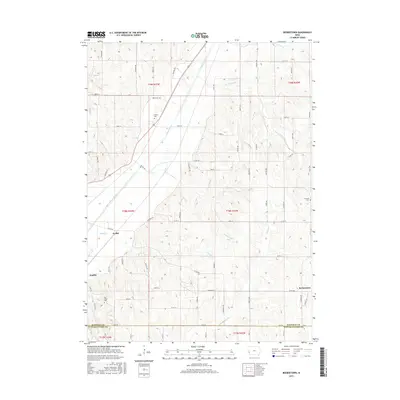
2015 Map of Beebeetown
USGS Topo · Published 2015About this map
Boyer River meanders through the northwest corner of this Harrison County landscape, defining a topography of drainage systems that flow toward the Missouri River valley. Small rural settlements like Beebeetown and Euclid anchor the agricultural road grid, representing long-standing communities in this corner of Iowa. The map reveals the intricate network of creeks, including Harris Grove Cr and Timber Cr, which have shaped the local farming environment for generations. Genealogists and local historians will find several burial sites noted across the townships, such as Frazier Cem near the river and Oak Grove Cem further south. The boundary between Harrison and Pottawattamie counties runs along the southern edge of the survey, where the road network transitions into the neighboring county near Findley. This survey provides a clear view of the rural infrastructure at a time when the township-and-range system remained the dominant organizing force of the prairie landscape.
Find a feature on this map
71 named features on this map. Tap any name to fly to it.
Don’t see what you’re looking for? This feature index may not catch every label — zoom into the map to look around manually.
Map Details
Editions of this 2015 Beebeetown Map
This is the sole edition of this map. No revisions or reprints were ever made.
Other maps of this area

1893 · Omaha
USGS Topo · 1:62,500

1954 · Omaha
USGS Topo · 1:250,000

1956 · Underwood
USGS Topo · 1:24,000

1957 · Omaha
USGS Topo · 1:250,000

1957 · Loveland
USGS Topo · 1:24,000

1957 · Honey Creek
USGS Topo · 1:24,000

1958 · Omaha
USGS Topo · 1:250,000

1970 · Logan
USGS Topo · 1:24,000
1970 · Missouri Valley
USGS Topo · 1:24,000
1970 · Beebeetown
USGS Topo · 1:24,000