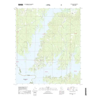
2018 Map of Beech Bayou
USGS Topo · Published 2018About this map
Zwolle sits at the northern edge of this 2018 survey, which documents the intricate shoreline and surrounding timberlands along the Louisiana-Texas border. The landscape is dominated by the Toledo Bend Reservoir, where flooded valleys create a labyrinth of peninsulas and inlets like Beech Bayou and Little Beech Bayou. To the south, the protected acreage of the Sabine National Forest preserves the woodland character of the Sabine Parish hills. This modern edition captures a region defined by recreational access and rural industry, featuring local landmarks such as Ammons Airport and the Old Saint Joseph Cem. Numerous named creeks and branches, including Choctaw Br and Bayou Scie, drain into the reservoir, illustrating the natural water network that existed before the valley was inundated.
Find a feature on this map
86 named features on this map. Tap any name to fly to it.
Don’t see what you’re looking for? This feature index may not catch every label — zoom into the map to look around manually.
Map Details
Editions of this 2018 Beech Bayou Map
This is the sole edition of this map. No revisions or reprints were ever made.
Other maps of this area

1941 · Zwolle
USGS Topo · 1:62,500

1944 · Negreet
USGS Topo · 1:62,500

1944 · Patroon
USGS Topo · 1:62,500

1944 · Zwolle
USGS Topo · 1:62,500

1953 · Alexandria
USGS Topo · 1:250,000
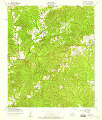
1954 · Negreet
USGS Topo · 1:24,000

1954 · Negreet
USGS Topo · 1:62,500

1954 · Salter Creek
USGS Topo · 1:24,000

1955 · Alexandria
USGS Topo · 1:250,000

1956 · Patroon
USGS Topo · 1:62,500