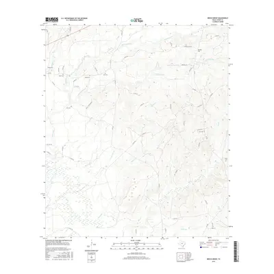
2016 Map of Beech Grove
USGS Topo · Published 2016About this map
Beech Grove and Spring Hill anchor this rural Jasper County landscape, defined by an intricate network of creeks and branches that drain into the Neches River watershed. The terrain is characterized by winding county roads like Garland Smith Rd and Springhill Ln that follow the natural rises and falls of the land between waterways. A high density of family-named burial sites, including Holton Cem, Sanders Cem, and Allen Cem, suggests a deeply rooted community where generations of families have maintained local landholdings. The drainage patterns are particularly complex here, with Big Walnut Run, Pickering Cr, and Robinson Br carving out distinct valleys. This 2016 survey provides a precise record of these long-standing homesteads and the various small tributaries, such as Blewett Br and Hurricane Br, which continue to shape the physical and social geography of this corner of East Texas.
Find a feature on this map
62 named features on this map. Tap any name to fly to it.
Don’t see what you’re looking for? This feature index may not catch every label — zoom into the map to look around manually.
Map Details
Editions of this 2016 Beech Grove Map
This is the sole edition of this map. No revisions or reprints were ever made.
Other maps of this area

1952 · Lake Charles
USGS Topo · 1:250,000

1954 · Lake Charles
USGS Topo · 1:250,000

1954 · Beaumont
USGS Topo · 1:250,000

1955 · Roganville
USGS Topo · 1:62,500

1955 · Curtis
USGS Topo · 1:62,500

1957 · Beaumont
USGS Topo · 1:250,000

1958 · Spurger
USGS Topo · 1:62,500

1958 · Kirbyville
USGS Topo · 1:62,500

1984 · Beaumont
USGS Topo · 1:250,000
1984 · Roganville
USGS Topo · 1:24,000