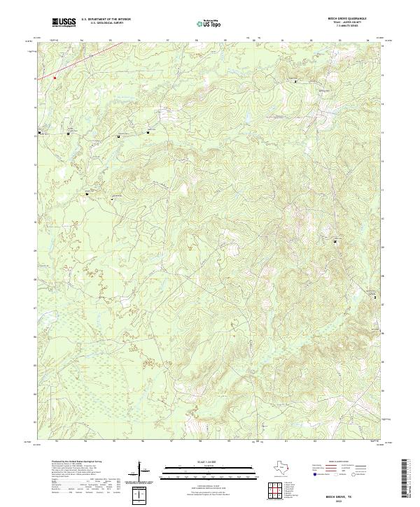
2022 Map of Beech Grove
USGS Topo · Published 2022About this map
Deep piney woods and creek bottoms define this portion of Jasper County, where the landscape is etched by the complex drainages of Big Walnut Run and Pickering Cr. The settlement pattern is notably decentralized, characterized by family burial grounds and small community cemeteries that speak to the deep-rooted genealogy of the region. Distinctive sites like the Rube Smith Burial Ground and the Holton - Grigsby Cem are tucked away near the winding paths of Little Walnut Run and Robinson Br.
Find a feature on this map
64 named features on this map. Tap any name to fly to it.
Don’t see what you’re looking for? This feature index may not catch every label — zoom into the map to look around manually.
Map Details
Editions of this 2022 Beech Grove Map
This is the sole edition of this map. No revisions or reprints were ever made.
Other maps of this area

1952 · Lake Charles
USGS Topo · 1:250,000

1954 · Lake Charles
USGS Topo · 1:250,000

1954 · Beaumont
USGS Topo · 1:250,000

1955 · Roganville
USGS Topo · 1:62,500

1955 · Curtis
USGS Topo · 1:62,500

1957 · Beaumont
USGS Topo · 1:250,000

1958 · Spurger
USGS Topo · 1:62,500

1958 · Kirbyville
USGS Topo · 1:62,500

1984 · Beaumont
USGS Topo · 1:250,000
1984 · Roganville
USGS Topo · 1:24,000