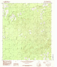
1984 Map of Beech Grove
USGS Topo · Published 1985About this map
Beech Grove anchors the northwest corner of this East Texas survey, where the landscape is defined by an intricate network of waterways draining toward the Neches River basin. Small rural settlements like Oak Hill and Spring Hill are situated along the higher ground between the numerous creeks and branches that dissect the timbered terrain. The drainage pattern is particularly dense in this area, with notable watercourses such as Sandy Creek, Big Walnut Run, and Hurricana Branch creating a complex topography of ridges and draws.
Find a feature on this map
16 named features on this map. Tap any name to fly to it.
Don’t see what you’re looking for? This feature index may not catch every label — zoom into the map to look around manually.
Map Details
Editions of this 1984 Beech Grove Map
This is the sole edition of this map. No revisions or reprints were ever made.
Other maps of this area

1952 · Lake Charles
USGS Topo · 1:250,000

1954 · Lake Charles
USGS Topo · 1:250,000

1954 · Beaumont
USGS Topo · 1:250,000

1955 · Roganville
USGS Topo · 1:62,500

1955 · Curtis
USGS Topo · 1:62,500

1957 · Beaumont
USGS Topo · 1:250,000

1958 · Spurger
USGS Topo · 1:62,500

1958 · Kirbyville
USGS Topo · 1:62,500

1984 · Beaumont
USGS Topo · 1:250,000
1984 · Roganville
USGS Topo · 1:24,000