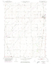
1953 Map of Beecher West
USGS Topo · Published 1974About this map
The village of Beecher stands at a significant rail junction in this mid-century survey of the Illinois borderlands. Situated near the line between Will and Kankakee Co, the landscape is defined by the heavy presence of the Chicago and Eastern Illinois and Louisville and Nashville railroads. These lines supported the small settlements of Sollitt and Whitaker while navigating a complex drainage system of named sloughs and creeks, including Exline Slough and Marshall Slough.
Find a feature on this map
25 named features on this map. Tap any name to fly to it.
Don’t see what you’re looking for? This feature index may not catch every label — zoom into the map to look around manually.
Map Details
Editions of this 1953 Beecher West Map
2 editions found

Other maps of this area

1922 · Momence
USGS Topo · 1:62,500

1922 · Kankakee
USGS Topo · 1:62,500

1924 · Momence
USGS Topo · 1:62,500

1924 · Kankakee
USGS Topo · 1:62,500

1929 · Dyer
USGS Topo · 1:24,000

1930 · Dyer
USGS Topo · 1:24,000

1930 · Frankfort
USGS Topo · 1:24,000

1930 · Steger
USGS Topo · 1:24,000

1949 · Peotone
USGS Topo · 1:62,500

1949 · Crete
USGS Topo · 1:62,500