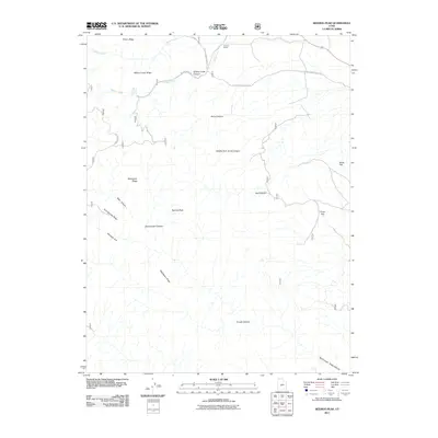
2011 Map of Beehive Peak
USGS Topo · Published 2011About this map
Beehive Peak stands as the central landmark in this rugged corner of Sevier County, where the high-country terrain is defined by a complex network of ridges and canyons. The northern reaches are marked by Pharo Ridge and the deep incision of Willow Creek Canyon, while the southern landscape descends through Trough Canyon toward North Cedar Ridge Canyon. Settlement is sparse in this upland environment, with the Herbert Ranch appearing as the primary named site near the confluence of Willow Creek and Pharo Creek. The map details an intricate system of forest roads, including Forest Service Road 102 and Forest Service Road 910, which provide access to remote landmarks like Willow Creek Spring and the high plateaus of Ezras Flat and Frogs Flat. The drainage patterns of Amos Canyon and Sweetwater Canyon illustrate the erosive forces that have shaped the region's topography.
Find a feature on this map
24 named features on this map. Tap any name to fly to it.
Don’t see what you’re looking for? This feature index may not catch every label — zoom into the map to look around manually.
Map Details
Editions of this 2011 Beehive Peak Map
This is the sole edition of this map. No revisions or reprints were ever made.
Other maps of this area

1885 · Manti
USGS Topo · 1:250,000

1885 · Beaver
USGS Topo · 1:250,000

1885 · Sevier Desert
USGS Topo · 1:250,000

1885 · Fish Lake
USGS Topo · 1:250,000

1895 · Manti
USGS Topo · 1:250,000

1896 · Fish Lake
USGS Topo · 1:250,000

1953 · Richfield
USGS Topo · 1:250,000

1953 · Delta
USGS Topo · 1:250,000

1956 · Salina
USGS Topo · 1:250,000

1956 · Price
USGS Topo · 1:250,000