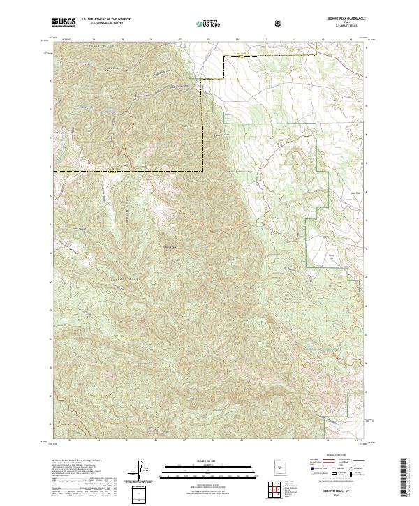
2023 Map of Beehive Peak
USGS Topo · Published 2023About this map
The high ridges of the Pahvant Range dominate this modern survey, marking the jagged boundary between Millard and Sevier Counties. Much of the territory falls within the Fishlake National Forest, where a complex network of pack trails and forest paths, such as the Paiute (D-1) Trl and Pharo Trl, navigates the steep elevation changes. Prominent landforms like Beehive Peak and Mahogany Ridge overlook deeply incised drainages, including Sweetwater Canyon and Strawberry Canyon.
Find a feature on this map
38 named features on this map. Tap any name to fly to it.
Don’t see what you’re looking for? This feature index may not catch every label — zoom into the map to look around manually.
Map Details
Editions of this 2023 Beehive Peak Map
This is the sole edition of this map. No revisions or reprints were ever made.
Other maps of this area

1885 · Manti
USGS Topo · 1:250,000

1885 · Beaver
USGS Topo · 1:250,000

1885 · Sevier Desert
USGS Topo · 1:250,000

1885 · Fish Lake
USGS Topo · 1:250,000

1895 · Manti
USGS Topo · 1:250,000

1896 · Fish Lake
USGS Topo · 1:250,000

1953 · Richfield
USGS Topo · 1:250,000

1953 · Delta
USGS Topo · 1:250,000

1956 · Salina
USGS Topo · 1:250,000

1956 · Price
USGS Topo · 1:250,000