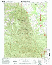
2001 Map of Beehive Peak
USGS Topo · Published 2003About this map
Beehive Peak stands as the central landmark in this high-altitude section of the Fishlake National Forest at the start of the 21st century. The landscape is defined by a complex network of high ridges and deep drainage systems, where the boundary between Millard and Sevier Counties cuts across the northern terrain near Pharo Ridge. The topography shows a transition from the steep elevations of Willow Creek Peak and Mahogany Ridge down into the lower, semi-arid basins of Denmark Wash. A variety of water sources, such as Willow Creek Spring and the ephemeral Pharo Creek, indicate the vital locations where livestock and wildlife would congregate in this arid environment. The map also reveals locally named plateaus like Ezras Flat and Frogs Flat, which break the verticality of the surrounding Red Canyon and Amos Canyon.
Find a feature on this map
24 named features on this map. Tap any name to fly to it.
Don’t see what you’re looking for? This feature index may not catch every label — zoom into the map to look around manually.
Map Details
Editions of this 2001 Beehive Peak Map
This is the sole edition of this map. No revisions or reprints were ever made.
Other maps of this area

1885 · Manti
USGS Topo · 1:250,000

1885 · Beaver
USGS Topo · 1:250,000

1885 · Sevier Desert
USGS Topo · 1:250,000

1885 · Fish Lake
USGS Topo · 1:250,000

1895 · Manti
USGS Topo · 1:250,000

1896 · Fish Lake
USGS Topo · 1:250,000

1953 · Richfield
USGS Topo · 1:250,000

1953 · Delta
USGS Topo · 1:250,000

1956 · Salina
USGS Topo · 1:250,000

1956 · Price
USGS Topo · 1:250,000