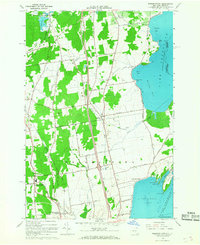
1966 Map of Beekmantown
USGS Topo · Published 1968About this map
The western shores of Lake Champlain define the character of this New York landscape, where the jagged coastline creates a series of protected inlets including Trombley Bay, Dunn Bay, and Treadwell Bay. In the mid-1960s, the newly constructed Adirondack Northway sliced north-south through the center of the map, providing a modern transport corridor alongside older routes like Ridge Road and the Delaware and Hudson Railroad.
Find a feature on this map
58 named features on this map. Tap any name to fly to it.
Don’t see what you’re looking for? This feature index may not catch every label — zoom into the map to look around manually.
Map Details
Editions of this 1966 Beekmantown Map
2 editions found
Other maps of this area

1894 · Plattsburg
USGS Topo · 1:62,500

1895 · Mooers
USGS Topo · 1:62,500

1895 · Rouse Point
USGS Topo · 1:62,500

1899 · Mooers
USGS Topo · 1:62,500

1906 · Plattsburg
USGS Topo · 1:62,500

1907 · Rouse Point
USGS Topo · 1:62,500

1913 · Dannemora
USGS Topo · 1:62,500

1939 · Rouses Point
USGS Topo · 1:62,500

1939 · Plattsburg
USGS Topo · 1:62,500

1941 · Plattsburg
USGS Topo · 1:62,500