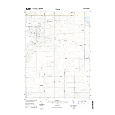
2014 Map of Belding
USGS Topo · Published 2014About this map
Belding serves as the primary municipal center in this western Michigan landscape, situated where the Flat River winds through the border of Ionia and Montcalm counties. The town is defined by a dense street grid featuring thoroughfares like W Ellis Ave and S Bridge St, surrounded by several commemorative sites including Belding Cem, Saint Joseph Cem, and River Ridge Cem. The surrounding townships are marked by a regular section grid and numerous glacial water bodies such as Lake Ranney, Haney Lake, and Long Lake. To the southeast, the small settlement of Orleans sits near the local drainage of Bellamy Cr and Spring Brook. The presence of several outlying burial grounds like Green Cem, Greenop Cem, and Easton Cem provides significant points of interest for those researching local family history across the rural landscape of T8N and T7N.
Find a feature on this map
107 named features on this map. Tap any name to fly to it.
Don’t see what you’re looking for? This feature index may not catch every label — zoom into the map to look around manually.
Map Details
Editions of this 2014 Belding Map
This is the sole edition of this map. No revisions or reprints were ever made.
Other maps of this area

1916 · Ionia
USGS Topo · 1:62,500

1918 · Ionia
USGS Topo · 1:62,500

1918 · Lowell
USGS Topo · 1:62,500

1943 · Ionia
USGS Topo · 1:62,500

1943 · Lowell
USGS Topo · 1:62,500

1954 · Midland
USGS Topo · 1:250,000

1958 · Midland
USGS Topo · 1:250,000

1958 · Grand Rapids
USGS Topo · 1:250,000

1959 · Midland
USGS Topo · 1:250,000

1961 · Grand Rapids
USGS Topo · 1:250,000